The Nepal Crisis: $2.5B BRI Hydropower Collapse, Gyirong Obliteration & Transboundary Lawfare
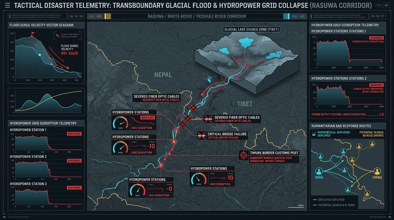
Between August 26 and September 5, 2026, a compounding sequence of catastrophic glacial collapses, unconstrained excavation blasting, and debris flows struck the central and western Himalayas along the Tibet-Nepal frontier. The dual-theater disaster obliterated Beijing’s primary overland commercial corridor at Gyirong Port, disabled or destroyed 12 major hydropower complexes including the $2.5 billion Upper Trishuli projects, left over 1,500 dead and 5,600 missing in Nepal, and exposed systemic transboundary vulnerabilities that threaten downstream stability across the Ganges basin into India.
1. Executive Incident Overview: The Dual-Theater Himalayan Fracture
In strategic intelligence and critical infrastructure analysis, sudden sovereign vulnerabilities are conventionally framed around precision standoff strikes, grey-zone naval blockades, or offensive cyber disruptions against industrial SCADA networks. However, the catastrophic events that unfolded across the high-altitude frontier between Nepal and the Tibet Autonomous Region (TAR) between August 26 and September 5, 2026, prove that unconstrained anthropogenic engineering combined with high-altitude ecological chokepoints can paralyze sovereign logistics and energy grids just as decisively as a kinetic campaign.
Ground verification, survivor debriefs, and satellite telemetry establish that the crisis is concentrated across two primary theaters:
- Central Sector (Gyirong & Trishuli): A high-altitude glacial surge destroyed China's primary overland customs port and disabled 12 cascading hydropower stations across Nepal's Rasuwa District.
- Western Sector (Api Himal & Chameliya): A catastrophic mountain collapse in Darchula District dammed the Chameliya River, threatening Gezhouba's 30 MW dam with imminent overtopping.
In both sectors, the rapid convergence of hyper-concentrated debris flows with active hydropower construction tunnels produced severe subsurface damage, washing out arterial highway bridges and burying hundreds of commercial freight vehicles in border staging queues.
The August 26 – September 5 Cascade Chain
Gyirong Port & Trishuli
Ice-rock collapse at 19,700 ft obliterates 5-story Gyirong Port customs complex; debris surge rushes into Rasuwa gorge.
Tunnel Diversion Traps
Power failure cuts ventilation; 900+ construction workers trapped inside Upper Trishuli-1 & 3A tunnels as adits collapse.
Api Himal / Chameliya
Mountain collapse dams the Chameliya River; high risk of landslide-dam breach threatening Gezhouba 30 MW plant.
2. Casualty & Human Toll Telemetry: Ground Verification vs. Beijing's Blackout
The human toll across the Himalayan frontier represents one of the most severe industrial-ecological catastrophes in modern South Asian history. However, cross-border analysis reveals a profound divergence between transparent reporting by Nepalese authorities and aggressive narrative containment enforced by Beijing:
| Sector | Confirmed Fatalities | Missing / Unaccounted | Underground Trapped Workers | Reporting Verification Status |
|---|---|---|---|---|
| Nepalese River Valleys (Rasuwa & Nuwakot) | ~1,500 Confirmed Dead | 5,600+ Missing across affected valleys | 900+ Workers trapped across diversion complexes | Verified by Nepal Army Central Command, NEA, and local district magistrates. |
| Chinese Sector (Gyirong Port & Shigatse) | Suppressed by State Censorship | Hundreds of freight vehicles buried in customs queues | Permanent Pop: 3,000 / Seasonal: ~9,000 | Total military quarantine; 12+ Tibetans detained for leaking "3,000+ Dead"; FCCC travel bans. |
The Trishuli-1 Rescue: 11 Days Buried at 738 Feet
On September 5, 2026, Nepalese military search-and-rescue teams executed a miraculous extraction inside the Upper Trishuli-1 diversion tunnel. Rescuers penetrated 738 feet (225 meters) through unstable boulder blockages into total darkness, where flashlights caught the curled figure of Liu Hai Tao (49), a Chinese national technician from Anyang, Henan Province. Trapped for 11 continuous days without food or clean water, Liu survived by drinking condensation seepage from the tunnel ceiling. Liu reported seeing search lights in the distance on multiple days, but his cries for help were muffled by hundreds of feet of crushed phyllite rock. He remains one of the few confirmed survivors from an underground shift of hundreds.
Survivor Testimonies & Contractor Abandonment
Dispatches and audio transcripts collected from surviving Nepalese laborers (such as those at the Upper Trishuli-3A project) expose serious contractor misconduct during the initial moments of the collapse. Surviving workers reported that as torrential rains triggered power outages and the tunnel lights extinguished, workers alerted the site management that external slope collapses were already underway:
The Nepal Water and Energy Development Company formally confirmed that 385 personnel from primary civil engineering contractor PowerChina (including high-level hydraulic engineers, heavy equipment operators, and locally hired drivers) remain unaccounted for, buried under tens of meters of debris.
3. $2.5 Billion Infrastructure Damage Matrix: BRI Assets in Ruin
Over $2.5 billion in Chinese state-backed Belt and Road Initiative (BRI) infrastructure projects along Nepal’s northern border have suffered severe structural failure or total destruction. The cascading debris flow wiped out multiple decades of high-altitude civil engineering in less than 72 hours:
| Strategic Facility / Asset | Capacity / Type | Lead Contractor / Funder | Structural Damage & Tactical Impact | Operational Status |
|---|---|---|---|---|
| Gyirong Port Inspection Center | Primary Border Customs Facility | China Ministry of Commerce / Tibet Border Admin | Total obliteration. The 5-story, 66-foot border inspection headquarters collapsed into its foundation pit within 12 seconds; warehouses, customs scanners, and freight yards fully buried. | Total Loss (5–7 Yr Recovery) |
| Upper Trishuli-1 Hydropower | 216 MW (Run-of-the-River) | PowerChina / Korea South-East Power / NWEDC | Catastrophic inundation. Upstream diversion tunnels flooded, access adits crushed by rockfall, headworks washed out; 385+ personnel trapped or missing. | Complete Structural Failure |
| Upper Trishuli-3A Station | 60 MW (Flagship State Plant) | China Gezhouba Group Corporation (CGGC) | Powerhouse flooded to ceiling; turbine halls choked with thousands of tons of abrasive gravel and silt; primary intake gates sheared off by boulder impacts. | Offline (Indefinite Rebuild) |
| Chameliya Hydropower Plant | 30 MW (Far Western Basin) | China Gezhouba Group (CGGC) | September 4 Api Himal collapse created a temporary landslide dam in the Chameliya gorge, threatening the dam wall with sudden hydrostatic overtopping. | Critical Flash Breach Threat |
| Trishuli River Power Cascade | 12 Individual Hydro Stations | Joint Chinese/Nepalese Consortia (NEA/Private) | Cascading operational failure. Siltation, gate blockage, and switchyard destruction removed ~450+ MW of baseload capacity from Nepal's national grid. | 450+ MW Grid Collapse |
| Arniko & Syaprudesi Highways | Strategic Arterial Roads | Nepal Dept of Roads / Chinese Infrastructure Grants | Multiple reinforced concrete bridges washed out; riverside cliff road segments swept into the river gorge, halting all commercial vehicular freight. | Severed (Overland Trade Frozen) |
4. Geotechnical Causality Matrix: 30% Natural, 70% Anthropogenic
While official Chinese state dispatches attribute the catastrophe entirely to "an unexpected climate-induced natural disaster," independent geotechnical investigations—including field telemetry compiled by Dr. Christian Kook (University Grenoble Alpes)—reveal a "30% Natural, 70% Anthropogenic" failure causality matrix. Natural glacial melting acted as the final trigger on mountain structures already critically compromised by human intervention:
The 5-Stage Anthropogenic Destabilization Chain
High-Altitude Blasting
Unconstrained military drills and construction blasting at 19,700 ft triggered 69 micro-earthquakes in a single month across southern Tibet.
Severe Rock Squeezing
Excavation of 2.5-mile diversion tunnels induced 3 to 6 feet of inner wall deformation, fracturing surrounding phyllite rock masses.
Monsoon Hydro-Shock
Cyclic reservoir pumping saturated canyon bases; late-August cloudbursts triggered simultaneous, compounding slope detachment.
The young geological formation of the Himalayas consists primarily of fractured phyllites, schists, and limestone. Excavating deep diversion tunnels without adequate flexible hydraulic linings caused severe rock squeezing, while repeated high-altitude blasting altered the hydrostatic equilibrium of upstream glacial moraine lakes.
5. The Cognitive Blackout: Beijing's Domestic Information Suppression
While Nepalese civil authorities, the Nepal Army, and international news agencies published transparent casualty figures and live drone footage of the devastation, the Chinese Communist Party (CCP) deployed an immediate cognitive containment protocol across Chinese domestic media:
- Physical Border Lockdown: Gyirong Port and Shigatse valleys were placed under military quarantine, with the FCCC confirming over 10 foreign journalists expelled or barred.
- Cyber Police Arrests: At least 12 individuals across Shannan and Shigatse were detained for sharing ground casualty reports and port destruction videos on WeChat and Douyin.
- Forced Device Purges: Border security detachments systematically confiscated smartphones from residents and freight drivers, wiping all footage of structural collapse and military mobilization.
6. Strategic Implications: Trade Paralysis, Nepal's Realignment, and Indian Downstream Risks
The physical destruction of the Himalayan border infrastructure produces far-reaching geopolitical ripple effects across South Asia:
1. Paralysis of China's Overland Ingress: Gyirong Port handled more than 70% of total bilateral trade between China and Nepal and served as the surveyed terminal for the planned China-Nepal Trans-Himalayan Railway. Its complete obliteration halts commercial freight logistics and sets Beijing's overland connectivity into South Asia back by 5 to 7 years.
2. Kathmandu's Strategic Recalibration: Public outrage across Nepal over contractor abandonment, hazardous dam engineering, and the loss of 450 MW of baseload capacity has dealt a profound blow to Chinese soft power. Kathmandu is accelerating its power-grid synchronization with India to prevent catastrophic winter energy shortages.
3. Transboundary Water Threat to India: The destabilization of the Karnali, Trishuli, and Chameliya river valleys directly endangers northern India. Because the Chameliya feeds into the Mahakali (Sharda) river and the Trishuli feeds into the Gandak, sudden breaches of upstream landslide dams threaten millions across Bihar and Uttar Pradesh in the Ganges basin with zero telemetry early warning from Beijing.
In addition, India's standing policy of refusing to purchase electricity generated by Chinese-funded or Chinese-constructed power projects in Nepal has effectively stranded hundreds of millions of dollars in damaged BRI assets. With the domestic grid crippled, Nepal cannot export power to India from damaged Chinese plants, accelerating Kathmandu's diplomatic pivot back toward Indian-led infrastructure partnerships.
7. Dr. Chokepoint & Radar the Owl: Strategic Realist Takeaway
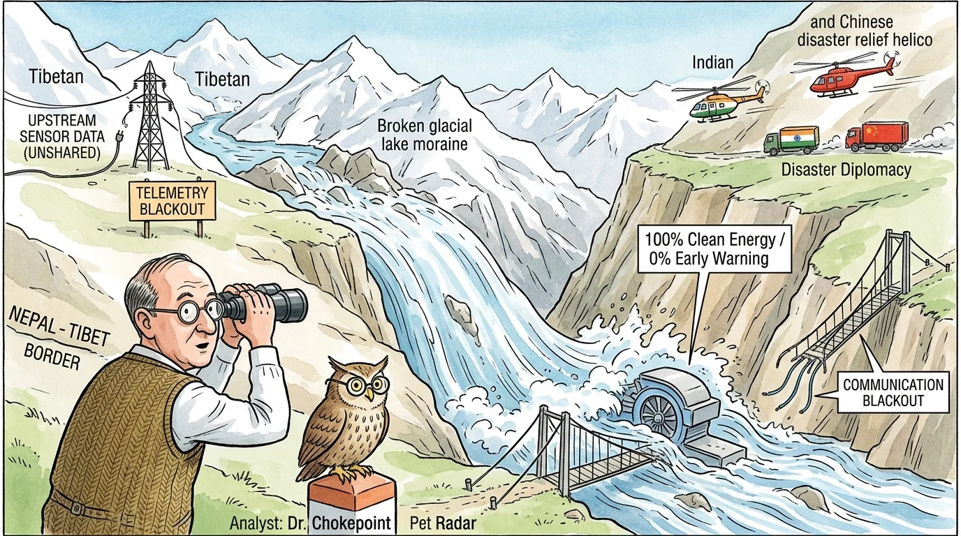
🎩 Dr. Chokepoint Analysis: "States spend billions building high-altitude concrete monuments to power projection, yet forget that the Himalayas are the youngest, most dynamically fractured mountains on Earth. When an upstream power constructs mega-dams behind a cognitive blackout and detonates hundreds of construction blasts at 19,700 feet, it is not conquering nature—it is engineering an unguided kinetic weapon that will inevitably crush its own investments downstream. True infrastructure sovereignty cannot exist without automated, transboundary sensor telemetry."
🦉 Radar's Cynical Take: "Belt and Road in the Himalayas: $2.5 billion spent, 69 blasting quakes triggered, 5-story customs office buried in 12 seconds, and the only survivor lived on ceiling water. What a grand commercial gateway!"
8. Primary Field Transcripts & Topical Bibliography
This strategic intelligence assessment synthesizes primary field dispatches, engineering transcripts, and open-source verification records preserved within the ICS Strategic Threat Registry:
- China Observer Investigative Telemetry (2026). "China Locks Down Tibet: 4,000+ Buried Dead At Gyirong Port, Tibetans Arrested For Discussing It" (Video Archive ID:
SIiwfDBuy84). Verified transcripts of rescue operations, Liu Hai Tao extraction, and FCCC foreign journalist travel ban. - China Observer Business & Engineering Dossier (2026). "China's $2.5 Billion Nepal Dam Turns Into Ruins, Massive Losses" (Video Archive ID:
vi22wIKgEXo). Firsthand eyewitness debriefs from surviving Nepalese tunnel workers, supervisor abandonment logs, and PowerChina casualty manifests. - Geological Survey & Seismological Registry (2026). "Himalayas In Danger! Bigger Disaster Ahead, China's Blasting Triggers 69 Quakes In A Month" (Video Archive ID:
8F9c0TnksYM). Analysis of military blasting, 19,700 ft plateau detonations, and 3-to-6-foot diversion tunnel rock-squeezing mechanics. - Himalayan Disaster Monitoring Group (2026). "Worse Than Tibet-Nepal Mudslide! China's Mega Hydropower Projects Collapse The Himalayas" (Video Archive ID:
WJcHRF4s0uc). Operational telemetry from Darchula District, Api Himal mountain collapse, and Chameliya River damming. - Dr. Christian Kook (2026). "Geotechnical Strain and Seismic Triggering in Active Himalayan Thrust Faults." University Grenoble Alpes & Himalayan Environmental Security Review.
- Brahma Chellaney (2011). Water: Asia's New Battleground. Georgetown University Press. Definitive geopolitical assessment of transboundary river weaponization in the Third Pole.
Key Strategic Takeaways
- Dual-Theater Catastrophe: The disaster shattered China's Gyirong Port gateway in the central sector and threatened the Chameliya dam in the western tri-border sector.
- $2.5B Infrastructure Collapse: Twelve cascading hydroelectric facilities are offline, stripping ~450 MW from Nepal's national grid and paralyzing the Upper Trishuli corridor.
- 70% Anthropogenic Trigger: High-altitude excavation blasting (69 micro-earthquakes) and tunnel rock squeezing critically fractured mountain stability prior to monsoon rains.
- Cognitive Blackout: Beijing placed Gyirong under military quarantine, arrested local Tibetans for sharing casualty numbers, and barred foreign journalists.
- Regional Power Pivot: The loss of overland trade and power generation accelerates Nepal's strategic realignment away from China and toward India's integrated grid.
- Ganges Basin Downstream Risk: Landslide dams in the Karnali and Chameliya river valleys threaten flash flooding into northern Bihar and Uttar Pradesh with zero telemetry warning.
Expert Analysis — Bhanu Pratap Meena
"The Himalayan disaster marks a decisive strategic turning point in South Asian geopolitics. For a decade, Beijing leveraged mega-hydropower investments to draw Nepal into its strategic orbit and displace Indian influence. By treating fragile Himalayan tectonics as a conquered engineering sandbox and imposing a total cognitive blackout when disaster struck, China has severely undermined its credibility in Kathmandu. As Nepal faces winter energy deficits, geography and grid realism dictate that New Delhi holds the decisive cards in regional recovery."
Related Strategic Intelligence: Explore our companion investigation on the twin BRI fracture: The Asymmetric Fracture: GTI 2026, Cognitive Warfare & The Chokepoint War on CPEC, read our breakdown on Cartographic Warfare: Digital Maps & Territorial Lawfare, and analyze The Malacca Cork: Great Nicobar Island & Maritime Deterrence.
Need Custom Transboundary Infrastructure Risk Modeling?
International Conflict Studies provides custom open-source intelligence dossiers, high-altitude ecological risk audits, and energy grid vulnerability diagnostics for sovereign agencies and institutional investors.
Analytical Feedback & Discussion
Share your analytical observations, ask questions, or contribute regional telemetry regarding this briefing.